Contact Us

ENGG 40’=1’’

ENGG 40’=1’’

Research & Development

We build the tools

that capture sites faster.that make inspections smarter.that turn scans into answers.that keep projects moving.

Research that starts in the field

Our R&D grows out of the work itself. Every scan, model and inspection shows us a step that could be faster, clearer or less manual. When the right tool doesn’t exist, we build it.

Owning our tools means we can shape them around how our teams really work, and keep improving them project after project.

Born in the field

Built for the problems we meet on real projects.

Built in-house

Our own tools, shaped around how we work.

Always evolving

Released step by step and tested on real work.

Featured: Cantos Lens

Our flagship platform. Cantos Lens is a browser-based viewer for exploring scanned stations in 360°. Site scans are only as useful as what you can do with them, so we built it around how our inspections and reviews actually happen: one place to walk the site, take measurements, document issues and export reports.

360°

station walkthroughs

14

measurement tools

Offline

mobile inspections

CSV & PDF

issue exports

01  Walk the site, remotely

  • 360° walkthroughs from the browser, with a minimap and level selection.
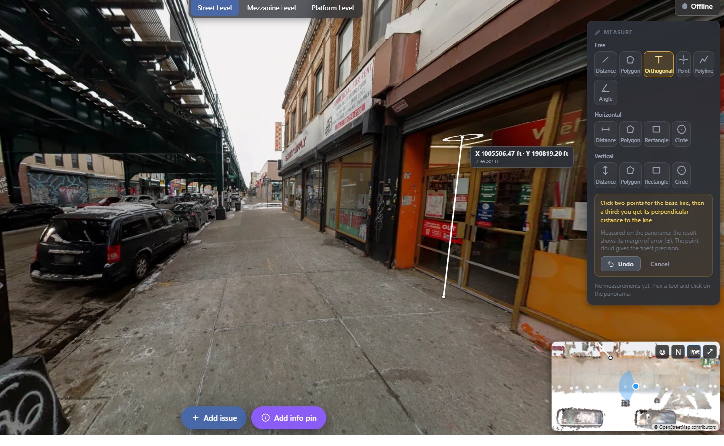
  • 14 measurement tools, floor plans and section views for preliminary dimensional checks, design coordination and work planning.
  • Every measurement shows its error margin. Dimensions required for formal design or acceptance are still verified according to project requirements.
Measurement tools work directly on the panorama.

02  Findings become records

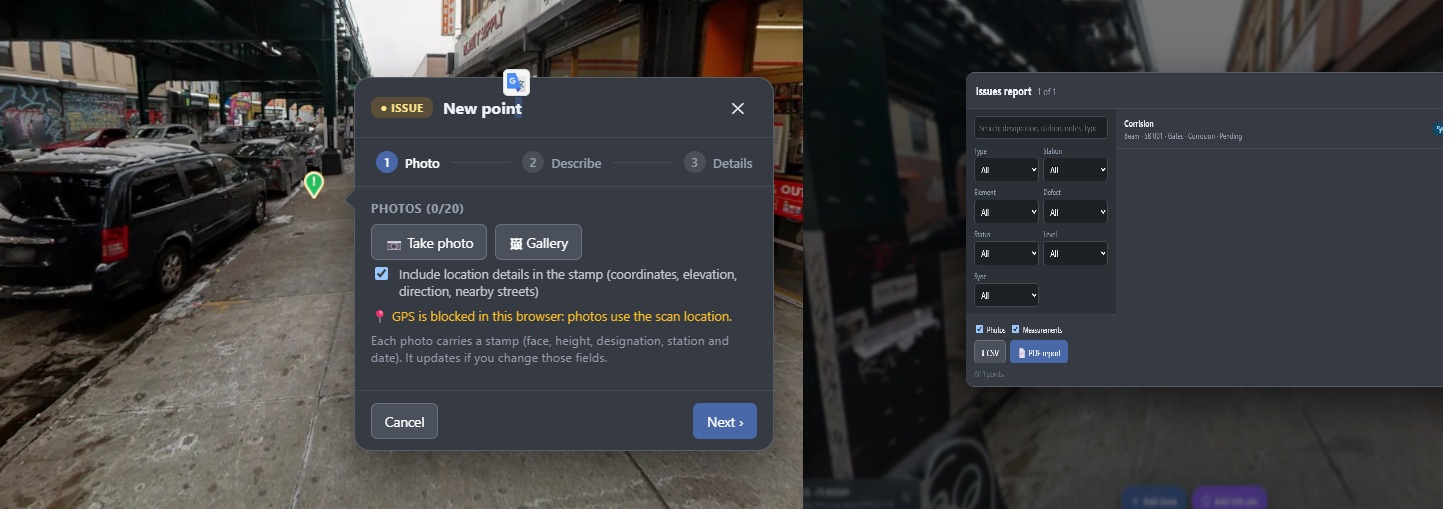
Inspectors mark issues directly on the panorama and record the element, defect type, priority, status, reporting person, date and coordinates.

  • Search, filter and export records to CSV or PDF.
  • Role-based access and an activity log for controlled access and traceability.
Each issue is logged with its element, defect type, priority and status.

03  Fieldwork without signal

Underground stations rarely have reliable connectivity. With the mobile version, inspectors download a level in advance, review conditions, take measurements and record issues offline, then synchronize when they are back online.

Why we build our own tools

  • Tools shaped around our workflows, not the other way around.
  • Faster reviews and report delivery, by moving field inspections from paper to a digital, georeferenced process.
  • A permanent digital record that serves as a reference for future interventions, with fewer return trips to the field for spot checks.
  • Over time, less reliance on third-party software licenses, so we can offer more competitive services. Specific savings will be quantified through project pilots.

What’s in the pipeline

Running locally

3D point-cloud processing

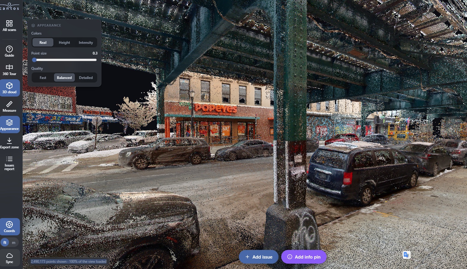
Full 3D point-cloud viewing, zone exports and new-scan processing, today in a local computing environment.

In testing

Plans from point clouds

Point-cloud-based plan generation, being tested and not yet broadly available.

Exploring

AI in BIM

Exploring how AI can recognize components in scans and link them with BIM models, inspection checklists and quality records, plus smarter spatial navigation and data analysis.

New ideas start on real projects, so this list never stops changing.

3D point-cloud view, currently available through a local computing environment.

Our goal is simple: to give every project everything it needs, from the first scan to the final inspection, in tools built to make the work easier.

See Cantos Lens in action

Request a walkthrough

112 W 34th St, New York, NY, 10120

Our offices are located in the financial district with ease of access both in physical and online accessibility.